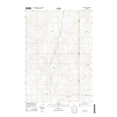
2013 Map of Webb Creek
USGS Topo · Published 2013About this map
Ola Valley and Sweet Valley anchor this 2013 topographic study of the canyon and ridge landscape along the Gem and Boise County line. The terrain is defined by the deep drainage of Squaw Creek and its many tributaries, including Webb Creek and Fourmile Creek, which carve through the high ground. The Sweet Ola Highway serves as the primary corridor through this section of the Payette River watershed, connecting isolated homesteads and ranching areas. Higher elevations are marked by landmarks like Timber Butte and Dyes Gulch. For local historians, the map documents a network of named rural routes such as Brownlee Road, Pratt Loop, and Liberty Road, illustrating the modern connectivity of this interior Idaho ranching country near the Box Spring area.
Find a feature on this map
31 named features on this map. Tap any name to fly to it.
Don’t see what you’re looking for? This feature index may not catch every label — zoom into the map to look around manually.
Map Details
Editions of this 2013 Webb Creek Map
This is the sole edition of this map. No revisions or reprints were ever made.
Other maps of this area

1892 · Boise
USGS Topo · 1:125,000

1894 · Squaw Creek
USGS Topo · 1:125,000

1897 · Boise
USGS Topo · 1:125,000

1953 · Banks
USGS Topo · 1:62,500

1953 · Montour
USGS Topo · 1:62,500

1955 · Baker
USGS Topo · 1:250,000

1955 · Boise
USGS Topo · 1:250,000

1957 · Horseshoe Bend
USGS Topo · 1:24,000

1958 · Boise
USGS Topo · 1:250,000

1959 · Baker
USGS Topo · 1:250,000