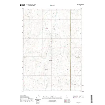
2020 Map of Webb Creek
USGS Topo · Published 2020About this map
Ola Valley and Sweet Valley anchor this portion of Gem County, where the Sweet Ola Hwy follows the winding path of Squaw Creek. The landscape is defined by its complex drainage network, including Big Cottonwood Cr and Little Cottonwood Cr to the west, and the northern reaches of Webb Creek. To the east, the terrain rises toward Timber Butte near the Gem and Boise County line. The distribution of local roads like Liberty Rd and Brownlee Rd highlights the rural agricultural and ranching character of the region. Notable geographic points such as Box Spring and Dyes Gulch provide specific landmarks for those tracing land use or topographic history in this drainage-rich territory between the forks of the Soldier Creek system.
Find a feature on this map
31 named features on this map. Tap any name to fly to it.
Don’t see what you’re looking for? This feature index may not catch every label — zoom into the map to look around manually.
Map Details
Editions of this 2020 Webb Creek Map
This is the sole edition of this map. No revisions or reprints were ever made.
Other maps of this area

1892 · Boise
USGS Topo · 1:125,000

1894 · Squaw Creek
USGS Topo · 1:125,000

1897 · Boise
USGS Topo · 1:125,000

1953 · Banks
USGS Topo · 1:62,500

1953 · Montour
USGS Topo · 1:62,500

1955 · Baker
USGS Topo · 1:250,000

1955 · Boise
USGS Topo · 1:250,000

1957 · Horseshoe Bend
USGS Topo · 1:24,000

1958 · Boise
USGS Topo · 1:250,000

1959 · Baker
USGS Topo · 1:250,000