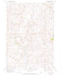
1970 Map of Webb Creek
USGS Topo · Published 1974About this map
Squaw Creek cuts a deep central valley through this high-country landscape along the Gem and Boise County border during the early 1970s. The terrain is defined by a network of seasonal drainages and named gulches, including Dyes Gulch and Rattlesnake Creek, which fed the regional watershed before modern intensive development. While the land is primarily characterized by its drainage systems like Webb Creek and Little Cottonwood Creek, human activity is visible in the form of the Liberty Mine and a regional power Substation. This period represents a quiet moment in the Idaho mountains, where transportation was still largely dependent on a network of primitive routes such as the Saddler Trail and numerous unnamed Jeep Trails that provided access to prominent landmarks like Timber Butte.
Find a feature on this map
23 named features on this map. Tap any name to fly to it.
Don’t see what you’re looking for? This feature index may not catch every label — zoom into the map to look around manually.
Map Details
Editions of this 1970 Webb Creek Map
This is the sole edition of this map. No revisions or reprints were ever made.
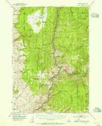
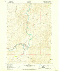
Other maps of this area

1892 · Boise
USGS Topo · 1:125,000

1894 · Squaw Creek
USGS Topo · 1:125,000

1897 · Boise
USGS Topo · 1:125,000
1953 · Banks
USGS Topo · 1:62,500

1953 · Montour
USGS Topo · 1:62,500

1955 · Baker
USGS Topo · 1:250,000

1955 · Boise
USGS Topo · 1:250,000
1957 · Horseshoe Bend
USGS Topo · 1:24,000

1958 · Boise
USGS Topo · 1:250,000

1959 · Baker
USGS Topo · 1:250,000