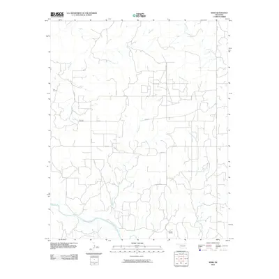
2010 Map of Webb
USGS Topo · Published 2010About this map
Canadian River curves through the southern reaches of this landscape, defining the local drainage and topography. The area is characterized by a grid-like network of rural roads such as N2130 Rd and E0750 Rd that navigate the creek-carved terrain. Several smaller waterways, including Bull Creek, Burnt Creek, and Panther Creek, dissect the plains as they flow toward the main river channel. For genealogists and local historians, the sheet is anchored by several distinct burial grounds, including Yake Cemetery in the northwest, Riverview Cemetery near the central drainage, and Halcomb Cemetery in the southeast. These sites, along with the scattered rural infrastructure, provide a clear record of the settlement patterns and land use in this part of Dewey County during the early 21st century.
Find a feature on this map
21 named features on this map. Tap any name to fly to it.
Don’t see what you’re looking for? This feature index may not catch every label — zoom into the map to look around manually.
Map Details
Editions of this 2010 Webb Map
This is the sole edition of this map. No revisions or reprints were ever made.
Other maps of this area

1955 · Clinton
USGS Topo · 1:250,000

1955 · Woodward
USGS Topo · 1:250,000

1957 · Clinton
USGS Topo · 1:250,000

1958 · Woodward
USGS Topo · 1:250,000

1961 · Leedey
USGS Topo · 1:62,500

1962 · Aledo
USGS Topo · 1:62,500

1969 · Mutual SW
USGS Topo · 1:24,000

1969 · Lenora
USGS Topo · 1:24,000

1969 · Camargo
USGS Topo · 1:24,000

1984 · Foss Reservoir
USGS Topo · 1:100,000