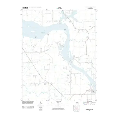
2010 Map of Webbers Falls
USGS Topo · Published 2010About this map
Webbers Falls sits at the confluence of the Arkansas River and Dirty Creek, serving as a focal point for this river-centered landscape in eastern Oklahoma. The modern hydrology of the area is dominated by the Webbers Falls Reservoir and the nearby Greenleaf Lake, which is contained by the Greenleaf Lake Dam. Historically significant terrain features like Salt Spring Mountain and Padgett Bluff rise above the river valley, overlooking a network of named river curves including Milligan Bend and Brewer Bend. The landscape is dotted with ancestral landmarks and small family burial grounds, such as Vaught Cemetery and Phillips Cemetery, which provide valuable locations for local genealogy. Regional transportation is anchored by the Muskogee Tpke and local aviation at Horne Airport, reflecting the area's development into the 21st century while maintaining its rural and riparian character.
Find a feature on this map
36 named features on this map. Tap any name to fly to it.
Don’t see what you’re looking for? This feature index may not catch every label — zoom into the map to look around manually.
Map Details
Editions of this 2010 Webbers Falls Map
This is the sole edition of this map. No revisions or reprints were ever made.
Other maps of this area

1900 · Sansbois
USGS Topo · 1:125,000

1901 · Muscogee
USGS Topo · 1:125,000

1905 · Muscogee
USGS Topo · 1:125,000

1909 · Sans Bois
USGS Topo · 1:125,000

1911 · Sansbois
USGS Topo · 1:125,000

1946 · Fort Smith
USGS Topo · 1:250,000

1948 · Keefeton
USGS Topo · 1:62,500

1948 · Webbers Falls
USGS Topo · 1:62,500

1950 · Keefeton
USGS Topo · 1:62,500

1950 · Webbers Falls
USGS Topo · 1:62,500