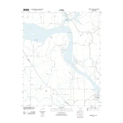
2012 Map of Webbers Falls
USGS Topo · Published 2012About this map
The Arkansas River dominates this region of eastern Oklahoma, flowing through a landscape defined by dramatic bends and prominent bluffs. In the early 21st century, the river's path is marked by substantial landmarks like Padgett Bluff and the sharp turn at Brewer Bend, where the waters transition into the Webbers Falls Reservoir. The settlement of Webbers Falls sits at the river's edge, showing a street grid that includes Gibson St and Commercial street, reflecting its role as a local center of commerce and transit near the Muskogee Tpke E.
Find a feature on this map
67 named features on this map. Tap any name to fly to it.
Don’t see what you’re looking for? This feature index may not catch every label — zoom into the map to look around manually.
Map Details
Editions of this 2012 Webbers Falls Map
This is the sole edition of this map. No revisions or reprints were ever made.
Other maps of this area

1900 · Sansbois
USGS Topo · 1:125,000

1901 · Muscogee
USGS Topo · 1:125,000

1905 · Muscogee
USGS Topo · 1:125,000

1909 · Sans Bois
USGS Topo · 1:125,000

1911 · Sansbois
USGS Topo · 1:125,000

1946 · Fort Smith
USGS Topo · 1:250,000

1948 · Keefeton
USGS Topo · 1:62,500

1948 · Webbers Falls
USGS Topo · 1:62,500

1950 · Keefeton
USGS Topo · 1:62,500

1950 · Webbers Falls
USGS Topo · 1:62,500