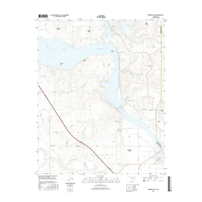
2016 Map of Webbers Falls
USGS Topo · Published 2016About this map
The Webbers Falls Reservoir dominates this landscape along the border of Muskogee and Sequoyah counties, where the Arkansas River has been transformed by engineering. The presence of Webbers Falls Lock and Dam 16 marks a critical point in the river's modern navigation system, while the surrounding terrain remains deeply tied to local family histories. Numerous burial sites are scattered across the bluffs and hills, including Vaught Cem, Phillips Cem, and Brewer Cem. The town of Webbers Falls sits near the river's bend, while Gore is situated to the east near the base of Sausbee Mtn. The map reveals a transition from the low-lying River Bottom to elevated features like Salt Spring Mtn and Hickory Ridge, illustrating how the waterway dictates the placement of both settlements and infrastructure like the Muskogee Tpke.
Find a feature on this map
46 named features on this map. Tap any name to fly to it.
Don’t see what you’re looking for? This feature index may not catch every label — zoom into the map to look around manually.
Map Details
Editions of this 2016 Webbers Falls Map
This is the sole edition of this map. No revisions or reprints were ever made.
Other maps of this area

1900 · Sansbois
USGS Topo · 1:125,000

1901 · Muscogee
USGS Topo · 1:125,000

1905 · Muscogee
USGS Topo · 1:125,000

1909 · Sans Bois
USGS Topo · 1:125,000

1911 · Sansbois
USGS Topo · 1:125,000

1946 · Fort Smith
USGS Topo · 1:250,000

1948 · Keefeton
USGS Topo · 1:62,500

1948 · Webbers Falls
USGS Topo · 1:62,500

1950 · Keefeton
USGS Topo · 1:62,500

1950 · Webbers Falls
USGS Topo · 1:62,500