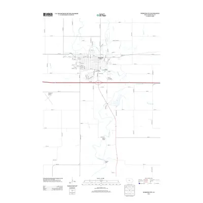
2013 Map of Webster City
USGS Topo · Published 2013About this map
Webster City sits at the heart of this landscape, its grid of streets branching out from the Boone River. The river's winding course defines the southern and eastern edges of the town, crossed by landmarks like the Albright Bridge and Tremaine Bridge. This 2013 survey illustrates the modern layout of the community, showing the integration of local history at the Bonebright Museum Complex alongside active recreational sites like the Hamilton County Speedway.
Find a feature on this map
100 named features on this map. Tap any name to fly to it.
Don’t see what you’re looking for? This feature index may not catch every label — zoom into the map to look around manually.
Map Details
Editions of this 2013 Webster City Map
This is the sole edition of this map. No revisions or reprints were ever made.
Other maps of this area

1954 · Waterloo
USGS Topo · 1:250,000

1955 · Waterloo
USGS Topo · 1:250,000

1978 · Blairsburg
USGS Topo · 1:24,000

1978 · Woolstock
USGS Topo · 1:24,000

1978 · Eagle Grove SW
USGS Topo · 1:24,000

1978 · Webster City
USGS Topo · 1:24,000
1978 · Stanhope
USGS Topo · 1:24,000

1978 · Jewell
USGS Topo · 1:24,000

1978 · Clarion SW
USGS Topo · 1:24,000
1978 · Duncombe
USGS Topo · 1:24,000