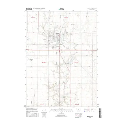
2015 Map of Webster City
USGS Topo · Published 2015About this map
The Boone River meanders southward through the center of this landscape, carving a wooded valley through the agricultural plains of Hamilton County. Within this corridor, historic river crossings such as Albright Bridge and Tremaine Bridge connect the rural road network. The city of Webster City serves as the regional hub, organized along a traditional grid of streets including Bank St, Elm St, and Walnut St. The town's social and institutional fabric is evident in the presence of the Iowa Central Community College, as well as Graceland Cem and Calvary Cem on its southern edge.
Find a feature on this map
61 named features on this map. Tap any name to fly to it.
Don’t see what you’re looking for? This feature index may not catch every label — zoom into the map to look around manually.
Map Details
Editions of this 2015 Webster City Map
This is the sole edition of this map. No revisions or reprints were ever made.
Other maps of this area

1954 · Waterloo
USGS Topo · 1:250,000

1955 · Waterloo
USGS Topo · 1:250,000

1978 · Blairsburg
USGS Topo · 1:24,000

1978 · Woolstock
USGS Topo · 1:24,000

1978 · Eagle Grove SW
USGS Topo · 1:24,000

1978 · Webster City
USGS Topo · 1:24,000
1978 · Stanhope
USGS Topo · 1:24,000

1978 · Jewell
USGS Topo · 1:24,000

1978 · Clarion SW
USGS Topo · 1:24,000
1978 · Duncombe
USGS Topo · 1:24,000