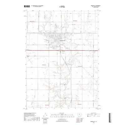
2018 Map of Webster City
USGS Topo · Published 2018About this map
The Boone River and its various tributaries, including White Fox Creek and Lyons Cr, shape the landscape around this Hamilton County community. The settlement of Webster City is shown with its established grid of residential streets, such as Elm St and Walnut St, concentrated north of the river's winding path. This 2018 survey reveals the town's local infrastructure, featuring Graceland Cem and Calvary Cem situated near the town center, while the Webster City Municipal Airport lies to the west.
Find a feature on this map
105 named features on this map. Tap any name to fly to it.
Don’t see what you’re looking for? This feature index may not catch every label — zoom into the map to look around manually.
Map Details
Editions of this 2018 Webster City Map
This is the sole edition of this map. No revisions or reprints were ever made.
Other maps of this area

1954 · Waterloo
USGS Topo · 1:250,000

1955 · Waterloo
USGS Topo · 1:250,000

1978 · Blairsburg
USGS Topo · 1:24,000

1978 · Woolstock
USGS Topo · 1:24,000

1978 · Eagle Grove SW
USGS Topo · 1:24,000

1978 · Webster City
USGS Topo · 1:24,000
1978 · Stanhope
USGS Topo · 1:24,000

1978 · Jewell
USGS Topo · 1:24,000

1978 · Clarion SW
USGS Topo · 1:24,000
1978 · Duncombe
USGS Topo · 1:24,000