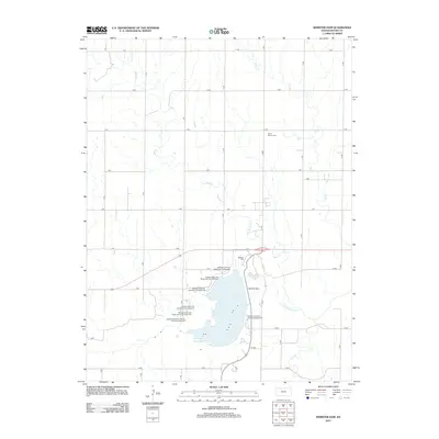
2012 Map of Webster Dam
USGS Topo · Published 2012About this map
The Webster Dam controls the flow of the S Fork Solomon River in this Rooks County landscape, creating the expansive Webster Reservoir that dominates the southern half of the quadrangle. This 2012 survey documents a region defined by its water management and recreational development, featuring numerous specialized camping zones such as the Mushroom Camping Area and Eagle Landing Campground. The surrounding terrain is organized by a rigid grid of rural roads, including F Rd and N Rd, which navigate the drainages of Sand Cr and Ash Cr. For those researching local history, the map preserves the locations of the Mount Vernon Cemetery and Webster Cemetery, while the varied terrain around Lost Cr suggests the natural character of the Kansas plains prior to the mid-century engineering projects that reshaped the river valley.
Find a feature on this map
35 named features on this map. Tap any name to fly to it.
Don’t see what you’re looking for? This feature index may not catch every label — zoom into the map to look around manually.
Map Details
Editions of this 2012 Webster Dam Map
This is the sole edition of this map. No revisions or reprints were ever made.
Other maps of this area

1893 · Norton
USGS Topo · 1:125,000

1893 · Phillipsburg
USGS Topo · 1:125,000

1893 · Hill
USGS Topo · 1:125,000

1896 · Plainville
USGS Topo · 1:125,000

1952 · Webster Dam
USGS Topo · 1:24,000

1953 · Stockton
USGS Topo · 1:24,000

1955 · Beloit
USGS Topo · 1:250,000

1959 · Beloit
USGS Topo · 1:250,000

1969 · Nicodemus
USGS Topo · 1:24,000

1969 · Palco
USGS Topo · 1:24,000