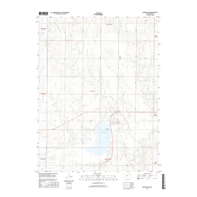
2015 Map of Webster Dam
USGS Topo · Published 2015About this map
Webster Reservoir dominates the landscape of this Rooks County region, created by the substantial engineering of the Webster Dam. The reservoir is fed and drained by the S Fork Solomon River, which snakes across the southern portion of the quadrangle. This 2015 survey illustrates a rural landscape defined by the Public Land Survey System, with a strict grid of roads such as F Rd and N Rd carving the terrain into sections. Away from the water, the upland areas are punctuated by small drainage systems like Sand Cr and Ash Cr. For those tracing local history, the Mount Vernon Cem stands as a notable landmark of early settlement patterns in a landscape otherwise defined by modern water management and agricultural plots.
Find a feature on this map
28 named features on this map. Tap any name to fly to it.
Don’t see what you’re looking for? This feature index may not catch every label — zoom into the map to look around manually.
Map Details
Editions of this 2015 Webster Dam Map
This is the sole edition of this map. No revisions or reprints were ever made.
Other maps of this area

1893 · Norton
USGS Topo · 1:125,000

1893 · Phillipsburg
USGS Topo · 1:125,000

1893 · Hill
USGS Topo · 1:125,000

1896 · Plainville
USGS Topo · 1:125,000

1952 · Webster Dam
USGS Topo · 1:24,000

1953 · Stockton
USGS Topo · 1:24,000

1955 · Beloit
USGS Topo · 1:250,000

1959 · Beloit
USGS Topo · 1:250,000

1969 · Nicodemus
USGS Topo · 1:24,000

1969 · Palco
USGS Topo · 1:24,000