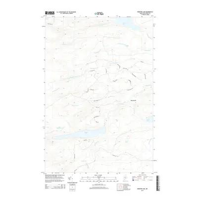
2014 Map of Webster Lake
USGS Topo · Published 2014About this map
Webster Lake dominates this northern Piscataquis County landscape, serving as a central hub for a complex network of waterways including Webster Brook and Thissell Brook. The 2014 survey reveals a dense grid of forestry and access roads such as Snake Pond Rd, Brayley Ridge Rd, and Webster Lake Rd, which thread through the timberlands between Thissell Bog and the E Br Penobscot River.
Find a feature on this map
39 named features on this map. Tap any name to fly to it.
Don’t see what you’re looking for? This feature index may not catch every label — zoom into the map to look around manually.
Map Details
Editions of this 2014 Webster Lake Map
This is the sole edition of this map. No revisions or reprints were ever made.
Other maps of this area

1953 · Telos Lake
USGS Topo · 1:62,500

1954 · Spider Lake
USGS Topo · 1:62,500

1954 · Millinocket Lake
USGS Topo · 1:62,500

1954 · Presque Isle
USGS Topo · 1:250,000

1955 · Traveler Mountain
USGS Topo · 1:62,500

1957 · Telos Lake
USGS Topo · 1:62,500

1958 · Presque Isle
USGS Topo · 1:250,000

1960 · Presque Isle
USGS Topo · 1:250,000

1961 · Spider Lake
USGS Topo · 1:62,500
1975 · Traveler Mountain NW
USGS Topo · 1:24,000