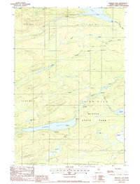
1988 Map of Webster Lake
USGS Topo · Published 1988About this map
Baxter State Park dominates the southern half of this landscape, reflecting a protected wilderness defined by complex waterways and timber township lines. This late-20th-century survey highlights a remote corridor where the East Branch Penobscot River flows near the northern edge of the park. The geography is anchored by Webster Lake, a significant water body flanked by designated backcountry locations such as the Ice Wagon Campsite and Boat House Campsite.
Find a feature on this map
33 named features on this map. Tap any name to fly to it.
Don’t see what you’re looking for? This feature index may not catch every label — zoom into the map to look around manually.
Map Details
Editions of this 1988 Webster Lake Map
This is the sole edition of this map. No revisions or reprints were ever made.
Other maps of this area

1953 · Telos Lake
USGS Topo · 1:62,500

1954 · Spider Lake
USGS Topo · 1:62,500

1954 · Millinocket Lake
USGS Topo · 1:62,500

1954 · Presque Isle
USGS Topo · 1:250,000

1955 · Traveler Mountain
USGS Topo · 1:62,500

1957 · Telos Lake
USGS Topo · 1:62,500

1958 · Presque Isle
USGS Topo · 1:250,000

1960 · Presque Isle
USGS Topo · 1:250,000

1961 · Spider Lake
USGS Topo · 1:62,500
1975 · Traveler Mountain NW
USGS Topo · 1:24,000