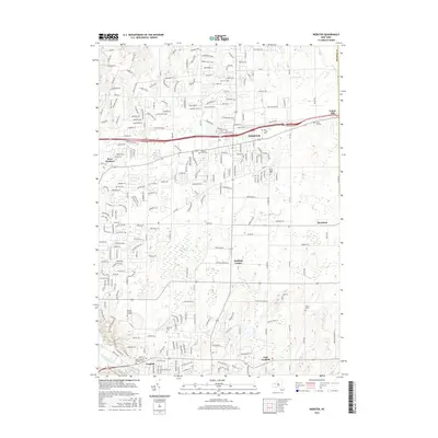
2016 Map of Webster
USGS Topo · Published 2016About this map
The Thousand Acre Swamp and its associated Thousand Acre Brook dominate the central landscape of this Monroe County region, illustrating a complex wetland ecosystem situated between developing residential corridors. To the south, the village of Penfield and East Penfield sit near the winding banks of Irondequoit Creek, while the northern portion of the map is anchored by the community of Webster and its surrounding suburban growth. Genealogists will find this area particularly detailed, with numerous established burial sites such as the Webster Rural Cem, Oakwood Cem, and the Pioneer Burying Ground providing a window into the early settlement patterns of the township. The eastern edge transition toward Union Hill and Roseland showcases the steady expansion of local road networks like Salt Rd and Co Rd 3 as they bridge the gap between historic hamlet centers and modern residential subdivisions like Woodsboro Farms.
Find a feature on this map
241 named features on this map. Tap any name to fly to it.
Don’t see what you’re looking for? This feature index may not catch every label — zoom into the map to look around manually.
Map Details
Editions of this 2016 Webster Map
This is the sole edition of this map. No revisions or reprints were ever made.
Other maps of this area

1895 · Rochester
USGS Topo · 1:62,500

1895 · Ontario Beach
USGS Topo · 1:62,500

1898 · Rochester
USGS Topo · 1:62,500

1899 · Ontario Beach
USGS Topo · 1:62,500

1900 · Macedon
USGS Topo · 1:62,500

1912 · Rochester
USGS Topo · 1:62,500

1912 · Ontario Beach
USGS Topo · 1:62,500

1920 · Rochester
USGS Topo · 1:62,500

1931 · Mendon Ponds
USGS Topo · 1:24,000

1931 · Rochester East
USGS Topo · 1:24,000