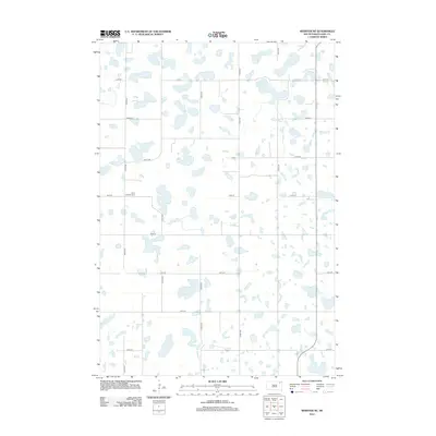
2012 Map of Webster NE
USGS Topo · Published 2012About this map
Glacial prairie potholes and scattered wetlands define this section of Day County, where the topography is shaped by the numerous water bodies that dot the landscape. A single cultural landmark, the Tabor Lutheran Cem, sits along 134th St near 430th Ave, serving as a central point for local genealogical interest in this rural farming region. In the northeast corner, Goose Lake stands out as the largest named body of water within a grid of section-line roads that includes 131st St and 138th St. The map illustrates the persistent intersection of early 20th-century township planning with the natural hydrology of the Dakotas, where the rectilinear road network frequently deviates to navigate around the region's characteristic sloughs and lakes.
Find a feature on this map
15 named features on this map. Tap any name to fly to it.
Don’t see what you’re looking for? This feature index may not catch every label — zoom into the map to look around manually.
Map Details
Editions of this 2012 Webster NE Map
This is the sole edition of this map. No revisions or reprints were ever made.
Other maps of this area

1953 · Milbank
USGS Topo · 1:250,000

1958 · Milbank
USGS Topo · 1:250,000

1958 · Britton 4 SW
USGS Topo · 1:24,000

1970 · Eden
USGS Topo · 1:24,000

1970 · Britton 4 SE
USGS Topo · 1:24,000

1970 · Waubay SW
USGS Topo · 1:24,000

1970 · Roslyn
USGS Topo · 1:24,000

1973 · Lynn Lake
USGS Topo · 1:24,000

1973 · Webster
USGS Topo · 1:24,000

1973 · Bristol East
USGS Topo · 1:24,000