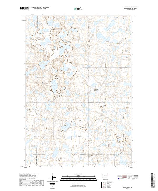
2021 Map of Webster NE
USGS Topo · Published 2021About this map
The glacial landscape of the Coteau des Prairies plateau defines this portion of Day County, characterized by a dense network of prairie potholes and small wetlands. In the northwestern corner, Goose Lake stands out as the primary named water body among hundreds of smaller unnamed basins. The area’s spiritual and community history is anchored by the Tabor Lutheran Church Cem, a central landmark for local genealogists and historians of the region's Scandinavian or German settlement heritage. The map details the rigid section-line road grid common to the Dakotas, including Co Rd 19 and Co Rd 12, which navigate around the numerous sloughs that persist across this upland terrain.
Find a feature on this map
19 named features on this map. Tap any name to fly to it.
Don’t see what you’re looking for? This feature index may not catch every label — zoom into the map to look around manually.
Map Details
Editions of this 2021 Webster NE Map
This is the sole edition of this map. No revisions or reprints were ever made.
Other maps of this area

1953 · Milbank
USGS Topo · 1:250,000

1958 · Milbank
USGS Topo · 1:250,000

1958 · Britton 4 SW
USGS Topo · 1:24,000

1970 · Eden
USGS Topo · 1:24,000

1970 · Britton 4 SE
USGS Topo · 1:24,000

1970 · Waubay SW
USGS Topo · 1:24,000

1970 · Roslyn
USGS Topo · 1:24,000

1973 · Lynn Lake
USGS Topo · 1:24,000

1973 · Webster
USGS Topo · 1:24,000

1973 · Bristol East
USGS Topo · 1:24,000