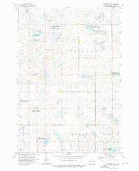
1973 Map of Webster NE
USGS Topo · Published 1976About this map
The prairie pothole region of Day County is defined by an extensive network of wetlands and conservation lands, as seen in this early 1970s survey. A significant portion of the landscape is dedicated to the National Waterfowl Production Area and various state-managed wildlife habitats, including the Lardy State Public Shooting Area and Nelson Slough State Public Shooting Area. These areas surround numerous glacial lakes and marshes, such as Goose Lake, which dominate the townships of Lynn, Raritan, Kidder, and Webster. Rural community life is anchored by the Tabor Ch and its adjacent Cem, located in the western portion of the quadrangle. The map also records a local Gravel Pit, providing a trace of the area's small-scale industrial activity alongside the primary agricultural and conservation uses of the land.
Find a feature on this map
16 named features on this map. Tap any name to fly to it.
Don’t see what you’re looking for? This feature index may not catch every label — zoom into the map to look around manually.
Map Details
Editions of this 1973 Webster NE Map
This is the sole edition of this map. No revisions or reprints were ever made.
Other maps of this area

1953 · Milbank
USGS Topo · 1:250,000

1958 · Milbank
USGS Topo · 1:250,000

1958 · Britton 4 SW
USGS Topo · 1:24,000

1970 · Eden
USGS Topo · 1:24,000

1970 · Britton 4 SE
USGS Topo · 1:24,000

1970 · Waubay SW
USGS Topo · 1:24,000

1970 · Roslyn
USGS Topo · 1:24,000

1973 · Lynn Lake
USGS Topo · 1:24,000

1973 · Webster
USGS Topo · 1:24,000

1973 · Bristol East
USGS Topo · 1:24,000