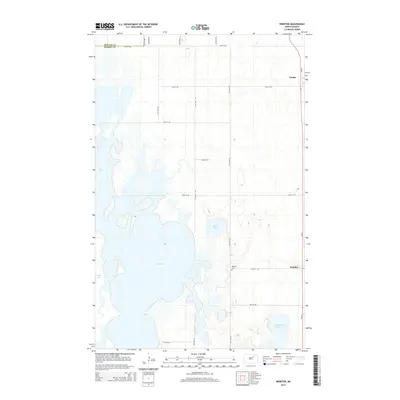
2014 Map of Webster
USGS Topo · Published 2014About this map
Dry Lake dominates the central landscape of this Ramsey County region, where the prairie is defined by a complex network of glacial wetlands and water bodies. The settlement of Webster sits to the east, anchored by the Webster Cem and connected by a rigid grid of rural section-line roads such as 60th St NE and 79th Ave NE. Further north, the small community of Garske appears near the northeastern boundary, highlighting the sparse, agricultural nature of the North Dakota plains. The geography is characterized by numerous basins including Stone Lake, Mikes Lake, and Cavanaugh Lake, illustrating a landscape where hydrology dictates the placement of infrastructure. This 2014 survey documents the enduring layout of these rural townships and the vital connection between the land and its small-town hubs.
Find a feature on this map
21 named features on this map. Tap any name to fly to it.
Don’t see what you’re looking for? This feature index may not catch every label — zoom into the map to look around manually.
Map Details
Editions of this 2014 Webster Map
This is the sole edition of this map. No revisions or reprints were ever made.
Other maps of this area

1931 · Devils Lake
USGS Topo · 1:62,500

1932 · Grahams Island
USGS Topo · 1:62,500

1950 · Grahams Island
USGS Topo · 1:62,500

1950 · Devils Lake
USGS Topo · 1:62,500

1951 · Grand Harbor
USGS Topo · 1:24,000

1951 · Penn
USGS Topo · 1:24,000

1951 · Sweetwater
USGS Topo · 1:24,000

1953 · Devils Lake
USGS Topo · 1:250,000

1956 · Devils Lake
USGS Topo · 1:250,000

1957 · Cando SE
USGS Topo · 1:24,000