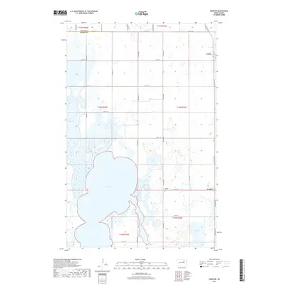
2017 Map of Webster
USGS Topo · Published 2017About this map
Dry Lake dominates the southwestern quadrant of this prairie landscape, where the flat terrain of the Devils Lake Basin is punctuated by numerous wetlands and small seasonal water bodies. The small settlement of Webster sits at a crossroads in the east, serving as a local hub for the surrounding agricultural sections. Just north of the town site, the Webster Cem provides a focal point for genealogical research in this sparsely populated region of Ramsey County. The landscape is defined by the rigid grid of the Public Land Survey System, with roads like 77th Ave NE and 60th St NE following section lines through the township. The proximity of the Towner Co and Ramsey Co border in the northwest corner highlights the jurisdictional layout of these North Dakota farming communities. In the northeast, the hamlet of Garske appears near the intersection of Co Hwy 10 and 81st Ave NE, reflecting the historical rail-aligned settlement pattern of the northern plains.
Find a feature on this map
30 named features on this map. Tap any name to fly to it.
Don’t see what you’re looking for? This feature index may not catch every label — zoom into the map to look around manually.
Map Details
Editions of this 2017 Webster Map
This is the sole edition of this map. No revisions or reprints were ever made.
Other maps of this area

1931 · Devils Lake
USGS Topo · 1:62,500

1932 · Grahams Island
USGS Topo · 1:62,500

1950 · Grahams Island
USGS Topo · 1:62,500

1950 · Devils Lake
USGS Topo · 1:62,500

1951 · Grand Harbor
USGS Topo · 1:24,000

1951 · Penn
USGS Topo · 1:24,000

1951 · Sweetwater
USGS Topo · 1:24,000

1953 · Devils Lake
USGS Topo · 1:250,000

1956 · Devils Lake
USGS Topo · 1:250,000

1957 · Cando SE
USGS Topo · 1:24,000