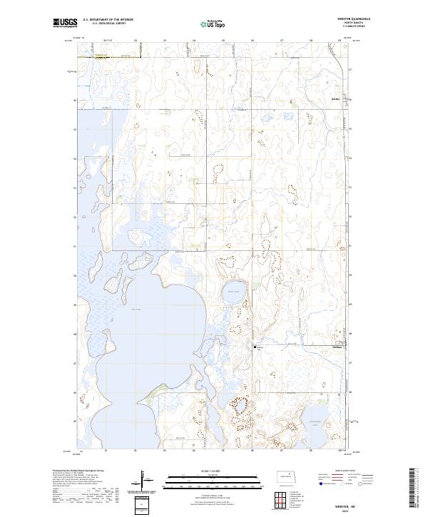
2024 Map of Webster
USGS Topo · Published 2024About this map
The settlement of Webster and the northern reaches of Dry Lake dominate this portion of the northern plains, where the grid of sections meets the shifting waters of Ramsey County. The landscape is characterized by its glacial prairie potholes and larger basins, including Stone Lake and Cavanaugh Lake, which provide a habitat protected within the Ramsey County Waterfowl Production Area. Local history is anchored by the Webster Cem and the small community of Garske to the northeast. Transportation follows the straight lines of the township and range system, with Co Hwy 10 and Railroad Ave providing the primary transit corridors through this agricultural region, reflecting the enduring rural character of North Dakota's lake country.
Find a feature on this map
30 named features on this map. Tap any name to fly to it.
Don’t see what you’re looking for? This feature index may not catch every label — zoom into the map to look around manually.
Map Details
Editions of this 2024 Webster Map
This is the sole edition of this map. No revisions or reprints were ever made.
Other maps of this area

1931 · Devils Lake
USGS Topo · 1:62,500

1932 · Grahams Island
USGS Topo · 1:62,500

1950 · Grahams Island
USGS Topo · 1:62,500

1950 · Devils Lake
USGS Topo · 1:62,500

1951 · Grand Harbor
USGS Topo · 1:24,000

1951 · Penn
USGS Topo · 1:24,000

1951 · Sweetwater
USGS Topo · 1:24,000

1953 · Devils Lake
USGS Topo · 1:250,000

1956 · Devils Lake
USGS Topo · 1:250,000

1957 · Cando SE
USGS Topo · 1:24,000