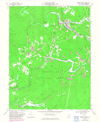
1966 Map of Webster Springs
USGS Topo · Published 1982About this map
Webster Springs serves as the focal point of this Central West Virginia landscape, where the Elk River meets the Back Fork Elk River. The map illustrates a region deeply defined by the extraction of natural resources, with numerous Strip Mines and several coal tipples dotting the ridges above the river valleys. Industrial infrastructure like the Baltimore and Ohio Railroad follows the winding riverbeds, connecting settlements like Bolair and Cherry Falls to larger markets. Cultural and social life is anchored by landmarks such as Camp Caesar and rural congregations at Pleasant Ridge Church and Beaver Run Church. This 1966 documentation, updated with 1979 photorevisions, provides a clear view of the mountain terrain within the Monongahela National Forest, showing the proximity of early settlements like Dyer and Doortown to active mining and quarrying operations.
Find a feature on this map
67 named features on this map. Tap any name to fly to it.
Don’t see what you’re looking for? This feature index may not catch every label — zoom into the map to look around manually.
Map Details
Editions of this 1966 Webster Springs Map
2 editions found
Other maps of this area

1889 · Nicholas
USGS Topo · 1:125,000

1891 · Nicholas
USGS Topo · 1:125,000

1891 · Huntersville
USGS Topo · 1:125,000

1893 · Buckhannon
USGS Topo · 1:125,000

1893 · Sutton
USGS Topo · 1:125,000

1894 · Huntersville
USGS Topo · 1:125,000

1896 · Buckhannon
USGS Topo · 1:125,000

1897 · Buckhannon
USGS Topo · 1:125,000

1901 · Nicholas
USGS Topo · 1:125,000

1908 · Sutton
USGS Topo · 1:48,000
Featured Places
- Addison (Webster Springs), WV
- Webster Springs, Addison (Webster Springs)
- Skidmore Crossing, WV
- Bolair, WV
- Excelsior, WV