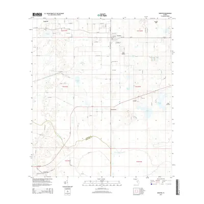
2015 Map of Webster
USGS Topo · Published 2015About this map
Webster and the surrounding agricultural hamlets of Linden and Tarrytown anchor this map of the Central Florida interior. The landscape is defined by its complex hydrology, where the Little Withlacoochee River meanders along the Sumter Co Hernando Co line. A series of distinctive water bodies, including Big Gant Lake, Little Gant Lake, and the Gant Lake Canal, illustrate the managed drainage and natural wetlands typical of the region. Genealogists will find significant value in the documentation of local burial sites such as Stewart Chapel Cem, Garden of Memories Cem, and Linden Cem. The map also captures the settlement at Richloam and the remote Cedar Hammock, providing a detailed look at the rural road network and township boundaries during the mid-2010s.
Find a feature on this map
94 named features on this map. Tap any name to fly to it.
Don’t see what you’re looking for? This feature index may not catch every label — zoom into the map to look around manually.
Map Details
Editions of this 2015 Webster Map
This is the sole edition of this map. No revisions or reprints were ever made.
Other maps of this area

1955 · Plant City
USGS Topo · 1:250,000

1955 · Orlando
USGS Topo · 1:250,000

1957 · Orlando
USGS Topo · 1:250,000

1958 · Orlando
USGS Topo · 1:250,000

1958 · Plant City
USGS Topo · 1:250,000

1958 · Webster
USGS Topo · 1:24,000

1958 · Bushnell
USGS Topo · 1:24,000

1958 · Wahoo
USGS Topo · 1:24,000

1958 · Saint Catherine
USGS Topo · 1:24,000

1959 · Plant City
USGS Topo · 1:250,000