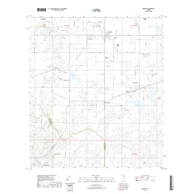
2018 Map of Webster
USGS Topo · Published 2018About this map
The Little Withlacoochee River and its associated wetlands define the southern reaches of this landscape near Richloam, where the terrain transitions into a dense network of marshes and bays. Further north, the settlement of Webster serves as a local hub, flanked by the Garden of Memories Cem and Oak Grove. The hydrology of the area is particularly complex, featuring numerous water bodies such as Big Gant Lake, Matchett Lake, and Giddon Lake, alongside significant swampy depressions like Indianhouse Swamp and Yankee Swamp.
Find a feature on this map
110 named features on this map. Tap any name to fly to it.
Don’t see what you’re looking for? This feature index may not catch every label — zoom into the map to look around manually.
Map Details
Editions of this 2018 Webster Map
This is the sole edition of this map. No revisions or reprints were ever made.
Other maps of this area

1955 · Plant City
USGS Topo · 1:250,000

1955 · Orlando
USGS Topo · 1:250,000

1957 · Orlando
USGS Topo · 1:250,000

1958 · Orlando
USGS Topo · 1:250,000

1958 · Plant City
USGS Topo · 1:250,000

1958 · Webster
USGS Topo · 1:24,000

1958 · Bushnell
USGS Topo · 1:24,000

1958 · Wahoo
USGS Topo · 1:24,000

1958 · Saint Catherine
USGS Topo · 1:24,000

1959 · Plant City
USGS Topo · 1:250,000