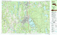
1982 Map of Webster
USGS Topo · Published 1984About this map
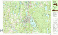
Webster Lake (Chaubunagungamaug) dominates the landscape of this tri-state border region, where the town of Webster serves as a central industrial and residential hub. The map illustrates a complex water network where the French River and Quinebaug River wind through valleys once defined by early New England manufacturing. Significant educational and religious landmarks, including Nichols College in Dudley and both St Anthony Cem and Holy Trinity Cem, indicate the established community structure of the early 1980s. To the east, the sprawling Douglas State Forest and Buck Hill State Management Area provide a stark contrast to the developed corridors of the Providence and Worcester railroad. The inclusion of smaller settlements like Manchaug and Fabyan near the Connecticut and Rhode Island borders highlights the interconnected nature of these rural and suburban outposts during this era of regional growth.
Find a feature on this map
105 named features on this map. Tap any name to fly to it.
Don’t see what you’re looking for? This feature index may not catch every label — zoom into the map to look around manually.
Map Details
Editions of this 1982 Webster Map
2 editions found
Other maps of this area

1886 · Blackstone
USGS Topo · 1:62,500

1887 · Brookfield
USGS Topo · 1:62,500

1889 · Blackstone
USGS Topo · 1:62,500

1889 · Webster
USGS Topo · 1:62,500

1889 · Putnam
USGS Topo · 1:62,500

1889 · Burrillville
USGS Topo · 1:62,500

1890 · Brookfield
USGS Topo · 1:62,500

1892 · Woodstock
USGS Topo · 1:62,500

1892 · Webster
USGS Topo · 1:62,500

1893 · Putnam
USGS Topo · 1:62,500