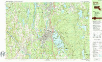
1982 Map of Webster
USGS Topo · Published 1984About this map
Chaubunagungamaug Lake, with its famously long name and complex shoreline of North Pond, Middle Pond, and South Pond, dominates the center of this Worcester County landscape. The industrial and educational character of the early 1980s is evident in the dense settlement of Webster and the presence of Nichols College in neighboring Dudley. Transport corridors are well-established, with Interstate 395 cutting north-south and the Providence & Worcester RR following the path of the French River through North Village and East Village.
Find a feature on this map
85 named features on this map. Tap any name to fly to it.
Don’t see what you’re looking for? This feature index may not catch every label — zoom into the map to look around manually.
Map Details
Editions of this 1982 Webster Map
2 editions found
Other maps of this area

1886 · Blackstone
USGS Topo · 1:62,500

1887 · Brookfield
USGS Topo · 1:62,500

1889 · Blackstone
USGS Topo · 1:62,500

1889 · Webster
USGS Topo · 1:62,500

1889 · Putnam
USGS Topo · 1:62,500

1889 · Burrillville
USGS Topo · 1:62,500

1890 · Brookfield
USGS Topo · 1:62,500

1892 · Woodstock
USGS Topo · 1:62,500

1892 · Webster
USGS Topo · 1:62,500

1893 · Putnam
USGS Topo · 1:62,500