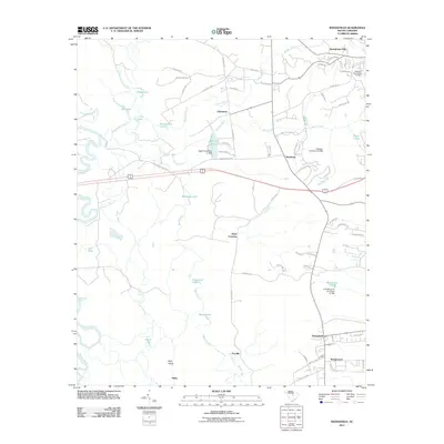
2011 Map of Wedgefield
USGS Topo · Published 2011About this map
The Wateree River defines the western edge of this landscape, its winding channel flanked by a complex network of swampy terrain and isolated water bodies. Inland from the river, settlements such as Stateburg and Wedgefield anchor the high ground, connected by established routes like Garners Ferry Rd. The area is characterized by numerous small lakes and named ponds, many of which are managed by significant engineering structures such as the Gillespie Pond Dam and H M McLaurin Pond Dam.
Find a feature on this map
74 named features on this map. Tap any name to fly to it.
Don’t see what you’re looking for? This feature index may not catch every label — zoom into the map to look around manually.
Map Details
Editions of this 2011 Wedgefield Map
This is the sole edition of this map. No revisions or reprints were ever made.
Other maps of this area

1938 · Hagood
USGS Topo · 1:62,500

1941 · Spartanburg
USGS Topo · 1:250,000

1942 · Camden
USGS Topo · 1:125,000

1943 · Eastover
USGS Topo · 1:62,500

1946 · Sumter
USGS Topo · 1:62,500

1953 · Poinsett State Park
USGS Topo · 1:24,000

1953 · Eastover
USGS Topo · 1:24,000

1953 · Wedgefield
USGS Topo · 1:24,000

1953 · Wateree
USGS Topo · 1:24,000

1953 · Rembert
USGS Topo · 1:24,000