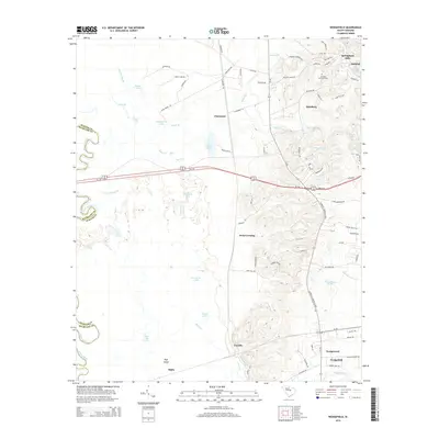
2014 Map of Wedgefield
USGS Topo · Published 2014About this map
General Sumters Tomb stands as a significant historical landmark in the hills near Stateburg, overlooking a landscape defined by the drainage systems of the Wateree River. This area of Sumter County is characterized by a distinct transition from the elevated, road-dense terrain around Springbank Hills and Oakland down into the expansive wetlands of the Wateree basin. The map reveals an intricate network of water bodies, including Ruggs Lake, Hurricane Lake, and Bland Lake, which dominate the western lowlands near Malta. To the south, the community of Wedgefield and its neighboring Wedgewood development mark the intersection of rail lines and state roads, while smaller named localities like Claremont and Dixie Crossing trace the historical movement patterns across the coastal plain before the modern expansion of the Us-378 corridor.
Find a feature on this map
88 named features on this map. Tap any name to fly to it.
Don’t see what you’re looking for? This feature index may not catch every label — zoom into the map to look around manually.
Map Details
Editions of this 2014 Wedgefield Map
This is the sole edition of this map. No revisions or reprints were ever made.
Other maps of this area

1938 · Hagood
USGS Topo · 1:62,500

1941 · Spartanburg
USGS Topo · 1:250,000

1942 · Camden
USGS Topo · 1:125,000

1943 · Eastover
USGS Topo · 1:62,500

1946 · Sumter
USGS Topo · 1:62,500

1953 · Poinsett State Park
USGS Topo · 1:24,000

1953 · Eastover
USGS Topo · 1:24,000

1953 · Wedgefield
USGS Topo · 1:24,000

1953 · Wateree
USGS Topo · 1:24,000

1953 · Rembert
USGS Topo · 1:24,000