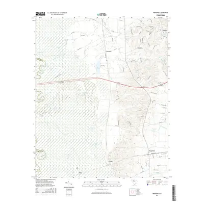
2017 Map of Wedgefield
USGS Topo · Published 2017About this map
General Sumters Tomb stands as a prominent landmark on the high ground near Stateburg, overlooking the expansive lowlands of the Wateree River valley. This 2017 survey details the complex hydrography of the Wateree Swamp, a dense network of wetlands where features like Jack Hole, Big Lake, and Hurricane Lake punctuate the bottomlands. The transition from the alluvial floodplains to the terrace is marked by settlements like Wedgefield and Claremont, while High Island and Malta sit at the very edge of the saturated terrain. The map illustrates a landscape shaped by water and memory, where numerous small ponds such as McLaurins Pond and Gillespie Pond dot the residential and agricultural areas rising above the swamp.
Find a feature on this map
89 named features on this map. Tap any name to fly to it.
Don’t see what you’re looking for? This feature index may not catch every label — zoom into the map to look around manually.
Map Details
Editions of this 2017 Wedgefield Map
This is the sole edition of this map. No revisions or reprints were ever made.
Other maps of this area

1938 · Hagood
USGS Topo · 1:62,500

1941 · Spartanburg
USGS Topo · 1:250,000

1942 · Camden
USGS Topo · 1:125,000

1943 · Eastover
USGS Topo · 1:62,500

1946 · Sumter
USGS Topo · 1:62,500

1953 · Poinsett State Park
USGS Topo · 1:24,000

1953 · Eastover
USGS Topo · 1:24,000

1953 · Wedgefield
USGS Topo · 1:24,000

1953 · Wateree
USGS Topo · 1:24,000

1953 · Rembert
USGS Topo · 1:24,000