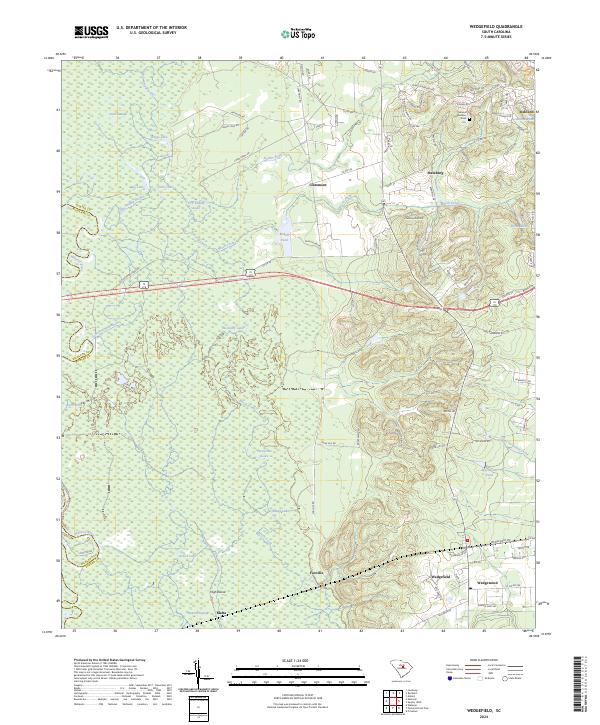
2024 Map of Wedgefield
USGS Topo · Published 2024About this map
General Sumters Tomb stands near Stateburg, anchoring a landscape where the High Hills of Santee meet the expansive lowlands of the Wateree River basin. This area of Sumter County is characterized by a dramatic shift from the elevated ridges of the east to the dense, water-logged terrain of the Wateree Swamp in the west. The transition is marked by numerous named lakes and ponds, including Ruggs Lake, Westbury Lake, and Dry Swamp Lake, which illustrate the complex hydrology of the Gum Swamp and Beech Creek systems.
Find a feature on this map
99 named features on this map. Tap any name to fly to it.
Don’t see what you’re looking for? This feature index may not catch every label — zoom into the map to look around manually.
Map Details
Editions of this 2024 Wedgefield Map
This is the sole edition of this map. No revisions or reprints were ever made.
Other maps of this area

1938 · Hagood
USGS Topo · 1:62,500

1941 · Spartanburg
USGS Topo · 1:250,000

1942 · Camden
USGS Topo · 1:125,000

1943 · Eastover
USGS Topo · 1:62,500

1946 · Sumter
USGS Topo · 1:62,500

1953 · Poinsett State Park
USGS Topo · 1:24,000

1953 · Eastover
USGS Topo · 1:24,000

1953 · Wedgefield
USGS Topo · 1:24,000

1953 · Wateree
USGS Topo · 1:24,000

1953 · Rembert
USGS Topo · 1:24,000