
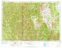
1958 Map of Weed
USGS Topo · Published 1963About this map
Mt Shasta dominates the eastern horizon of this Northern California survey, a landscape defined by high peaks and the intricate drainage of the Klamath River and Sacramento River systems. In the mid-1950s, the regional economy is clearly centered on the rail corridors and timber-rich mountains, with the Southern Pacific line running through the canyon at Dunsmuir and the McCloud River RR serving the logging areas to the east. The map captures a transition period for the timber industry and remote mining operations, such as the Holiday Mine and Tyson Chrome Mine tucked into the Siskiyou Mountains. In the west, the Hoopa Valley Indian Reservation and Prairie Creek Redwoods State Park mark significant land use boundaries, while the central valleys support established ranching and supply hubs like Yreka, Fort Jones, and Etna.
Find a feature on this map
135 named features on this map. Tap any name to fly to it.
Don’t see what you’re looking for? This feature index may not catch every label — zoom into the map to look around manually.
Map Details
Editions of this 1958 Weed Map
3 editions found
Other maps of this area

1886 · Lassen Peak
USGS Topo · 1:250,000

1886 · Modoc Lava Bed
USGS Topo · 1:250,000

1886 · Shasta
USGS Topo · 1:250,000

1889 · Klamath
USGS Topo · 1:250,000

1890 · Red Bluff
USGS Topo · 1:250,000

1891 · Ashland
USGS Topo · 1:250,000

1892 · Modoc Lava-Bed
USGS Topo · 1:250,000

1892 · Lassen Peak
USGS Topo · 1:250,000

1893 · Ashland
USGS Topo · 1:250,000

1894 · Lassen Peak
USGS Topo · 1:250,000