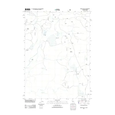
2012 Map of Weed Valley
USGS Topo · Published 2012About this map
Weed Valley and the surrounding high basins of Lake County are defined by a complex network of seasonal water management and grazing lands in this 2012 survey. The landscape is dotted with vital water sources such as Wild Horse Reservoir and Picnic Grove Reservoir, which supported the livestock operations at Weed Valley Ranch. These features, along with names like Coyote Meadow and Buchanan Flat, reflect a legacy of ranching in a region where water is the primary driver of settlement patterns. Kellogg Mountain rises as a central landmark, flanked by the drainage systems of Wild Horse Cr and N Fork Willow Cr. The map details an extensive system of forest roads, including Kellogg Rd, that link remote meadows like Jims Flat to the larger watershed at Janes Reservoir.
Find a feature on this map
61 named features on this map. Tap any name to fly to it.
Don’t see what you’re looking for? This feature index may not catch every label — zoom into the map to look around manually.
Map Details
Editions of this 2012 Weed Valley Map
This is the sole edition of this map. No revisions or reprints were ever made.
Other maps of this area

1886 · Alturas
USGS Topo · 1:250,000

1892 · Alturas
USGS Topo · 1:250,000

1954 · Alturas
USGS Topo · 1:250,000

1955 · Klamath Falls
USGS Topo · 1:250,000

1958 · Alturas
USGS Topo · 1:250,000

1958 · Klamath Falls
USGS Topo · 1:250,000

1960 · Strawberry Butte
USGS Topo · 1:62,500

1962 · Alturas
USGS Topo · 1:250,000

1962 · Steele Swamp
USGS Topo · 1:62,500

1962 · South Mountain
USGS Topo · 1:62,500