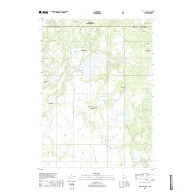
2018 Map of Weed Valley
USGS Topo · Published 2018About this map
Fremont National Forest and Modoc National Forest meet along the high-desert borderlands of Oregon and California, defined here by a series of high valleys and seasonal water catchments. The landscape is characterized by its drainage and storage systems, including Diamond Reservoir, Picnic Grove Reservoir, and Janes Reservoir. The northern portion of the map is marked by the Oregon-California state line, followed closely by the historical track of the Old State Line and its associated spurs. Terrain features like Weed Valley and Buchanan Flat are surrounded by significant heights such as Kellogg Mtn. Resource management is evident through the presence of a Rock Pit and a Beaver Dam, while the network of forest roads including Weyerhaeuser Road facilitates movement through these timberlands and meadows.
Find a feature on this map
45 named features on this map. Tap any name to fly to it.
Don’t see what you’re looking for? This feature index may not catch every label — zoom into the map to look around manually.
Map Details
Editions of this 2018 Weed Valley Map
This is the sole edition of this map. No revisions or reprints were ever made.
Other maps of this area

1886 · Alturas
USGS Topo · 1:250,000

1892 · Alturas
USGS Topo · 1:250,000

1954 · Alturas
USGS Topo · 1:250,000

1955 · Klamath Falls
USGS Topo · 1:250,000

1958 · Alturas
USGS Topo · 1:250,000

1958 · Klamath Falls
USGS Topo · 1:250,000

1960 · Strawberry Butte
USGS Topo · 1:62,500

1962 · Alturas
USGS Topo · 1:250,000

1962 · Steele Swamp
USGS Topo · 1:62,500

1962 · South Mountain
USGS Topo · 1:62,500