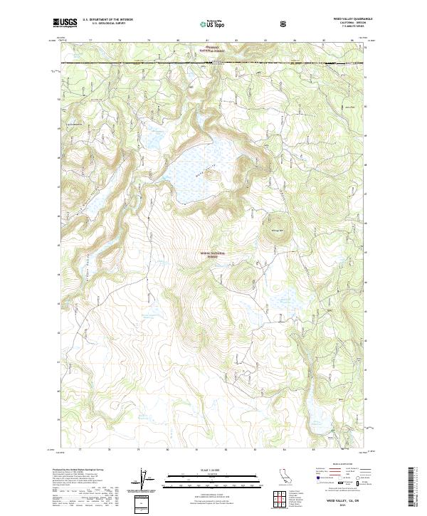
2021 Map of Weed Valley
USGS Topo · Published 2021About this map
Modoc National Forest and Fremont National Forest meet at the high-desert borderlands of California and Oregon, a landscape defined by volcanic geology and remote high flats. The historical Old State Line serves as a reminder of early boundary surveys across this territory. Water management is central to the land's utility, evidenced by a series of high-altitude catchments including Picnic Grove Reservoir, Baseball Reservoir, Rock Cr Reservoir, and Janes Reservoir. These features, along with named springs like Buckhorn Spring and Dip Spring, sustain the livestock and wildlife that frequent the open ranges. Lowland areas such as Coyote Meadow, Buchanan Flat, and Jims Flat offer rare stretches of level ground amidst the ridges of Kellogg Mtn and the depths of Hidden Valley. The presence of timber and ranching infrastructure like Weyerhaeuser Road and Crowder Flat road highlights the economic activity driving this secluded corner of the West.
Find a feature on this map
36 named features on this map. Tap any name to fly to it.
Don’t see what you’re looking for? This feature index may not catch every label — zoom into the map to look around manually.
Map Details
Editions of this 2021 Weed Valley Map
This is the sole edition of this map. No revisions or reprints were ever made.
Other maps of this area

1886 · Alturas
USGS Topo · 1:250,000

1892 · Alturas
USGS Topo · 1:250,000

1954 · Alturas
USGS Topo · 1:250,000

1955 · Klamath Falls
USGS Topo · 1:250,000

1958 · Alturas
USGS Topo · 1:250,000

1958 · Klamath Falls
USGS Topo · 1:250,000

1960 · Strawberry Butte
USGS Topo · 1:62,500

1962 · Alturas
USGS Topo · 1:250,000

1962 · Steele Swamp
USGS Topo · 1:62,500

1962 · South Mountain
USGS Topo · 1:62,500