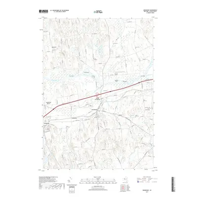
2019 Map of Weedsport
USGS Topo · Published 2019About this map
Port Byron and Weedsport anchor this Cayuga County landscape, defined by the persistent corridor of the Seneca River and its accompanying lowlands. The geography is heavily influenced by glacial features and waterways, with Skaneateles Cr joining the river near Bonta Bridge. The map reveals a dense network of local history, marked by numerous small family and community burial grounds such as Gods Acre Cem, Wilson Family Cem, and the Helmer Family Cem. North of the river, the terrain rises into the drumlins around Emerson, where Stark Pond and Muskrat Cr drain the higher ground. The infrastructure reflects a long-standing transportation hub, where the Whitfords Airport and the modern highway corridor parallel the older paths of the Cold Spring Brook through North Weedsport.
Find a feature on this map
118 named features on this map. Tap any name to fly to it.
Don’t see what you’re looking for? This feature index may not catch every label — zoom into the map to look around manually.
Map Details
Editions of this 2019 Weedsport Map
This is the sole edition of this map. No revisions or reprints were ever made.
Other maps of this area

1899 · Auburn
USGS Topo · 1:62,500

1899 · Skaneateles
USGS Topo · 1:62,500

1900 · Baldwinsville
USGS Topo · 1:62,500

1902 · Skaneateles
USGS Topo · 1:62,500

1902 · Weedsport
USGS Topo · 1:62,500

1902 · Auburn
USGS Topo · 1:62,500

1943 · Jordan
USGS Topo · 1:31,680

1943 · Lysander
USGS Topo · 1:31,680

1943 · Montezuma
USGS Topo · 1:31,680

1943 · Cayuga
USGS Topo · 1:31,680