2023 Map of Weedsport
USGS Topo · Published 2023About this map
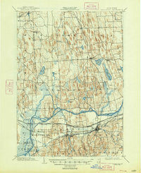
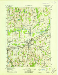
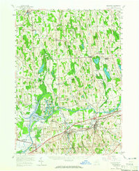
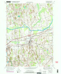
Weedsport and Port Byron anchor this portion of Cayuga County, positioned within a landscape defined by the winding course of the Seneca River. The terrain is marked by distinctive glacial features, including numerous drumlins and several river islands such as Hickory Island, Frost Island, and Nicholson Island. The drainage network is dense, with Skaneateles Creek, Muskrat Creek, and Cold Spring Brook feeding into the main river channel. For the local historian, the map identifies numerous small burial grounds and family plots across the countryside, including the Crim Cem, Meech Cem, and Lamphere Cem. The rural character of the region is punctuated by small hamlets like Emerson and the interestingly named Berry Hump, while Whitfords Airport serves as a modern landmark north of the river. The settlement pattern remains largely tied to the historical corridor established by the river and nearby canal routes, though modern transport is represented by the highway infrastructure bisecting the area.
Find a feature on this map
121 named features on this map. Tap any name to fly to it.
Don’t see what you’re looking for? This feature index may not catch every label — zoom into the map to look around manually.
Map Details
Editions of this 2023 Weedsport Map
This is the sole edition of this map. No revisions or reprints were ever made.
Historical Maps of North Weedsport Through Time
5 maps found