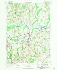
1954 Map of Weedsport
USGS Topo · Published 1956About this map
The Seneca River and the Erie Canal define the industrial and transit character of this central New York landscape during the mid-1950s. The village of Weedsport serves as a central hub, where the New York State Thruway intersects with older transportation arteries like the Lehigh Valley Railroad and the New York Central Railroad. Evidence of the region's hydraulic history is visible in the presence of the Weedsport Canal Terminal and sections of the Old Erie Canal winding through Mentz and Brutus.
Find a feature on this map
77 named features on this map. Tap any name to fly to it.
Don’t see what you’re looking for? This feature index may not catch every label — zoom into the map to look around manually.
Map Details
Editions of this 1954 Weedsport Map
4 editions found
Other maps of this area

1899 · Auburn
USGS Topo · 1:62,500

1899 · Skaneateles
USGS Topo · 1:62,500

1900 · Baldwinsville
USGS Topo · 1:62,500

1902 · Skaneateles
USGS Topo · 1:62,500

1902 · Weedsport
USGS Topo · 1:62,500

1902 · Auburn
USGS Topo · 1:62,500

1943 · Jordan
USGS Topo · 1:31,680

1943 · Lysander
USGS Topo · 1:31,680

1943 · Montezuma
USGS Topo · 1:31,680

1943 · Cayuga
USGS Topo · 1:31,680