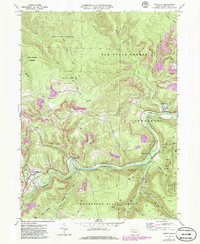
1970 Map of Weedville
USGS Topo · Published 1986About this map
The Bennett Branch of the Sinnemahoning Branch carves a deep path through Elk County, anchoring the settlements of Benezette and Weedville. This mid-century landscape reflects the region's industrial transitions, where an Old Railroad Grade and active Conrail lines run parallel to the winding waterways. The map documents extensive resource extraction across Gray Hill and near Caledonia, marked by numerous Strip Mines and a dense network of Gas Wells that extend into the surrounding timberlands. Local heritage is preserved at sites like Mt Zion Ch and Gray Cem, while the massive reaches of Elk State Forest and Moshannon State Forest dominate the high ridges. The integration of purple photorevision updates highlights 1980s developments in road infrastructure and land use, contrasting against the original 1970 survey data.
Find a feature on this map
36 named features on this map. Tap any name to fly to it.
Don’t see what you’re looking for? This feature index may not catch every label — zoom into the map to look around manually.
Map Details
Editions of this 1970 Weedville Map
3 editions found
Other maps of this area

1929 · Clearfield
USGS Topo · 1:48,000

1929 · Penfield
USGS Topo · 1:62,500

1932 · Clearfield
USGS Topo · 1:62,500

1932 · Penfield
USGS Topo · 1:62,500

1941 · Benezette
USGS Topo · 1:62,500

1941 · Ridgway
USGS Topo · 1:62,500

1943 · Benezette
USGS Topo · 1:62,500

1944 · Ridgway
USGS Topo · 1:62,500

1957 · Warren
USGS Topo · 1:250,000

1958 · Warren
USGS Topo · 1:250,000
Featured Places
- Benezette Township, PA
- Jay Township, PA
- Medix Run, Benezette Township
- Caledonia, Jay Township
- Weedville, Jay Township