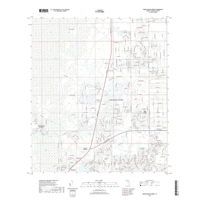
2018 Map of Weeki Wachee Spring
USGS Topo · Published 2018About this map
Weeki Wachee Spring serves as the focal point of this coastal Hernando County landscape, feeding the Weeki Wachee River as it winds westward through the Weeki Wachee Swamp. The 2018 survey illustrates a complex transition from the dense, undeveloped Chassahowitzka Swamp in the northwest to the concentrated residential footprints of North Weeki Wachee and High Point. This era of development is characterized by a dense grid of bird-named streets—such as Peregrine Falcon Ave and Mississippi Kite Ave—superimposed over the limestone-rich terrain. Smaller water bodies like Tooke Lake, Great Hope Pond, and Whitehurst Pond dot the region, while the southern margin reaches the community of Berkeley. The map provides a detailed view of the modern road network, including the commercial corridor along US Highway 19 as it intersects with local landmarks like Coon Wallow.
Find a feature on this map
155 named features on this map. Tap any name to fly to it.
Don’t see what you’re looking for? This feature index may not catch every label — zoom into the map to look around manually.
Map Details
Editions of this 2018 Weeki Wachee Spring Map
This is the sole edition of this map. No revisions or reprints were ever made.
Other maps of this area

1954 · Chassahowitzka Bay
USGS Topo · 1:24,000

1954 · Brooksville NW
USGS Topo · 1:24,000

1954 · Brooksville
USGS Topo · 1:24,000

1954 · Aripeka
USGS Topo · 1:24,000

1954 · Chassahowitzka
USGS Topo · 1:24,000

1954 · Bayport
USGS Topo · 1:24,000

1954 · Masaryktown
USGS Topo · 1:24,000

1954 · Weekiwachee Springs
USGS Topo · 1:24,000

1954 · Port Richey NE
USGS Topo · 1:24,000

1955 · Plant City
USGS Topo · 1:250,000