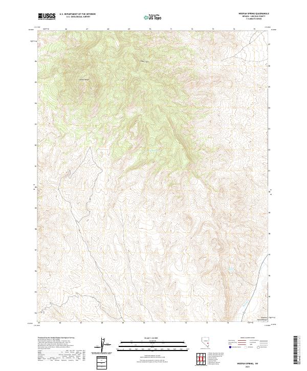
2021 Map of Weepah Spring
USGS Topo · Published 2021About this map
Weepah Spring sits at the heart of this high-desert landscape in Lincoln County, where the southern reaches of the Seaman Range meet the open terrain of eastern Nevada. The area is defined by its critical water sources in an otherwise arid environment, notably White Rock Spring and the drainage of the White River. These features have historically dictated the movement of people and livestock through the basin. High points like Timber Mtn provide significant vertical relief, overlooking a network of land divisions and section lines that mark the t1n r61e and t1n r62e townships. The map illustrates the classic Great Basin geography where isolated springs and seasonal watercourses like the White River serve as the primary landmarks for navigation and land use.
Find a feature on this map
12 named features on this map. Tap any name to fly to it.
Don’t see what you’re looking for? This feature index may not catch every label — zoom into the map to look around manually.
Map Details
Editions of this 2021 Weepah Spring Map
This is the sole edition of this map. No revisions or reprints were ever made.
Other maps of this area

1885 · Pioche
USGS Topo · 1:250,000

1886 · Pioche
USGS Topo · 1:250,000

1954 · Caliente
USGS Topo · 1:250,000

1956 · Lund
USGS Topo · 1:250,000

1959 · Caliente
USGS Topo · 1:250,000

1960 · Lund
USGS Topo · 1:250,000

1970 · Oreana Spring
USGS Topo · 1:24,000

1970 · Seaman Wash
USGS Topo · 1:24,000
1970 · Deadman Spring
USGS Topo · 1:24,000

1970 · Wheatgrass Spring
USGS Topo · 1:24,000