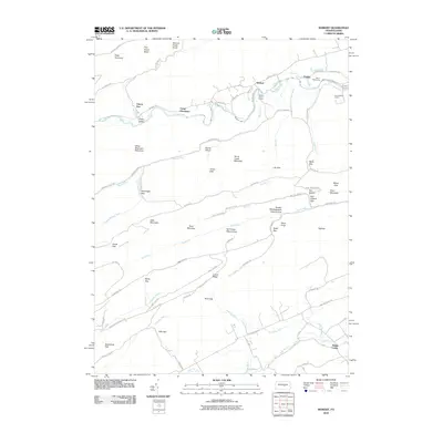
2010 Map of Weikert
USGS Topo · Published 2010About this map
Penns Creek winds through a landscape of high ridges and narrow valleys, serving as the central artery for the small settlements of Weikert and Pardee. This 2010 survey illustrates the area's preservation-focused character, dominated by the White Mountain Wild Area, Snyder Middleswarth Natural Area, and the Tall Timber Natural Area. These protected zones, alongside numerous recreation sites like Wesley Forest Camp and Camp Hironimus, indicate a regional shift toward conservation and outdoor education. The terrain is defined by a series of parallel mountains and gaps, including Buck Mountain, Penns Creek Mountain, and the prominent Devils Elbow. A network of unpaved forest roads and trails, such as Knob Ridge Rd and the Middle Ridge Trl, provides access to the deep interior valleys drained by Swift Run and Lick Run.
Find a feature on this map
86 named features on this map. Tap any name to fly to it.
Don’t see what you’re looking for? This feature index may not catch every label — zoom into the map to look around manually.
Map Details
Editions of this 2010 Weikert Map
This is the sole edition of this map. No revisions or reprints were ever made.
Other maps of this area

1907 · Millerstown
USGS Topo · 1:62,500

1925 · Mifflintown
USGS Topo · 1:48,000

1934 · Mifflintown
USGS Topo · 1:62,500

1937 · Mifflintown
USGS Topo · 1:62,500

1937 · Millheim
USGS Topo · 1:48,000

1938 · Mifflinburg
USGS Topo · 1:48,000

1941 · Millheim
USGS Topo · 1:62,500

1943 · Millerstown
USGS Topo · 1:62,500

1943 · Mifflinburg
USGS Topo · 1:62,500

1950 · Harrisburg
USGS Topo · 1:250,000
Featured Places
- Decatur Township, PA
- Hartley Township, PA
- Spring Township, PA
- Armagh Township, PA
- West Beaver Township, PA