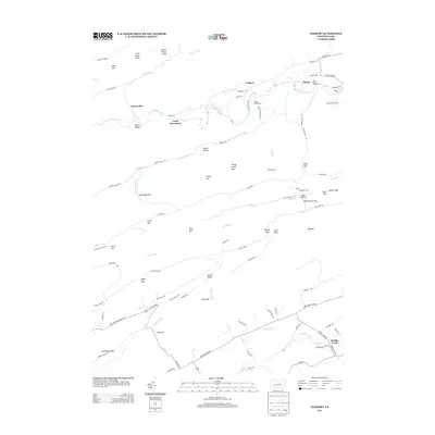
2013 Map of Weikert
USGS Topo · Published 2013About this map
Penns Creek and its many tributaries, including Cherry Run and Weikert Run, dominate this central Pennsylvania landscape. The map captures a high concentration of recreational and youth camps along the water, such as Nik-O-Mahs Camp, Karoondinha Camp, and Wesley Forest Camp, illustrating the area's long-standing role as a retreat for outdoor organizations. The settlement of Weikert serves as a small hub amidst a complex network of gaps and ridges, including Hoofnagle Gap, Wolfe Gap, and Lick Gap. The southern portion of the map transitions into the drainage for Middle Creek, where the small cluster of Middle Creek houses sits near the intersection of Back Mountain Rd and Stage Rd. The intricate trail system, featuring the Wolf Gap Trl and Pine Ridge Trl, highlights the extensive forest access through the ridges of Penns Creek Mtn and Locust Ridge.
Find a feature on this map
89 named features on this map. Tap any name to fly to it.
Don’t see what you’re looking for? This feature index may not catch every label — zoom into the map to look around manually.
Map Details
Editions of this 2013 Weikert Map
This is the sole edition of this map. No revisions or reprints were ever made.
Other maps of this area

1907 · Millerstown
USGS Topo · 1:62,500

1925 · Mifflintown
USGS Topo · 1:48,000

1934 · Mifflintown
USGS Topo · 1:62,500

1937 · Mifflintown
USGS Topo · 1:62,500

1937 · Millheim
USGS Topo · 1:48,000

1938 · Mifflinburg
USGS Topo · 1:48,000

1941 · Millheim
USGS Topo · 1:62,500

1943 · Millerstown
USGS Topo · 1:62,500

1943 · Mifflinburg
USGS Topo · 1:62,500

1950 · Harrisburg
USGS Topo · 1:250,000
Featured Places
- Decatur Township, PA
- Hartley Township, PA
- Spring Township, PA
- Armagh Township, PA
- West Beaver Township, PA