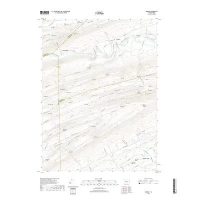
2019 Map of Weikert
USGS Topo · Published 2019About this map
Penns Creek carves a winding path through this corner of the Ridge-and-Valley Appalachians, serving as the primary drainage for the surrounding heights of Paddy Mtn and White Mtn. The small settlement of Weikert is situated along its banks, near the sharp bend known as Devils Elbow. The topography is defined by parallel ridges such as Penns Creek Mtn and Buck Mtn, which are separated by narrow valleys and hollows like Cherry Valley and Bull Hollow. Significant elevation is reached at Jacks Mountain Hightop, overlooking the lower drainages. Multiple mountain passes, including Green Gap, Lick Gap, and Blazer Gap, provided historical transit routes through the otherwise formidable terrain. Further south, the map captures the transition into New Lancaster Valley, where Honey Cr flows near Knob Ridge.
Find a feature on this map
106 named features on this map. Tap any name to fly to it.
Don’t see what you’re looking for? This feature index may not catch every label — zoom into the map to look around manually.
Map Details
Editions of this 2019 Weikert Map
This is the sole edition of this map. No revisions or reprints were ever made.
Other maps of this area

1907 · Millerstown
USGS Topo · 1:62,500

1925 · Mifflintown
USGS Topo · 1:48,000

1934 · Mifflintown
USGS Topo · 1:62,500

1937 · Mifflintown
USGS Topo · 1:62,500

1937 · Millheim
USGS Topo · 1:48,000

1938 · Mifflinburg
USGS Topo · 1:48,000

1941 · Millheim
USGS Topo · 1:62,500

1943 · Millerstown
USGS Topo · 1:62,500

1943 · Mifflinburg
USGS Topo · 1:62,500

1950 · Harrisburg
USGS Topo · 1:250,000
Featured Places
- Decatur Township, PA
- Hartley Township, PA
- Spring Township, PA
- Armagh Township, PA
- West Beaver Township, PA