
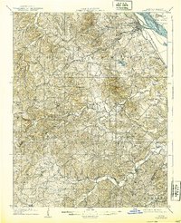
1909 Map of Weingarten
USGS Topo · Published 1909About this map
Ste Genevieve serves as the focal point of this 1907 survey, situated where the St Louis and San Francisco RR skirts the banks of the Mississippi River near Moro Island. The landscape transitions from the river bottoms to the rolling Beckett Hills, revealing an early 20th-century economy tied to both the land and the rails. Traces of historical transport routes are prominent, including the Illinois Plank Road and the Ste Genevieve and Ironton Road, which connected isolated settlements like New Offenburg and Weingarten.
Find a feature on this map
59 named features on this map. Tap any name to fly to it.
Don’t see what you’re looking for? This feature index may not catch every label — zoom into the map to look around manually.
Map Details
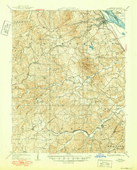
Editions of this 1909 Weingarten Map
3 editions found
Other maps of this area

1904 · Farmington
USGS Topo · 1:62,500

1906 · Farmington
USGS Topo · 1:62,500

1907 · Weingarten
USGS Topo · 1:62,500

1910 · Higdon
USGS Topo · 1:62,500

1912 · Baldwin
USGS Topo · 1:62,500

1914 · Baldwin
USGS Topo · 1:62,500

1915 · Renault
USGS Topo · 1:62,500

1915 · Chester
USGS Topo · 1:62,500

1915 · Crystal City
USGS Topo · 1:62,500

1923 · Perryville
USGS Topo · 1:62,500