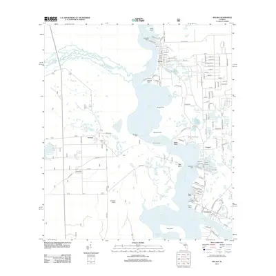
2012 Map of Welaka
USGS Topo · Published 2012About this map
Saint Johns River and the winding Ocklawaha River converge in this hydrologically complex reach of Putnam County, where the river expands into Little Lake George. The town of Welaka serves as a primary hub, characterized by a grid of streets named after tropical flora like Guava St and Tangelo St, reflecting the region's agricultural history. Further south, the map documents smaller riverside communities and landings such as Fruitland, Fort Gates, and Georgetown, the latter featuring the Georgetown Cem and Georgetown PO.
Find a feature on this map
104 named features on this map. Tap any name to fly to it.
Don’t see what you’re looking for? This feature index may not catch every label — zoom into the map to look around manually.
Map Details
Editions of this 2012 Welaka Map
This is the sole edition of this map. No revisions or reprints were ever made.
Other maps of this area

1912 · Palatka
USGS Topo · 1:48,000

1915 · Palatka
USGS Topo · 1:62,500

1915 · Interlachen
USGS Topo · 1:48,000

1916 · Interlachen
USGS Topo · 1:62,500

1944 · Interlachen
USGS Topo · 1:62,500

1949 · Rodman
USGS Topo · 1:24,000

1949 · Interlachen
USGS Topo · 1:62,500

1954 · Daytona Beach
USGS Topo · 1:250,000

1958 · Daytona Beach
USGS Topo · 1:250,000

1964 · Daytona Beach
USGS Topo · 1:250,000