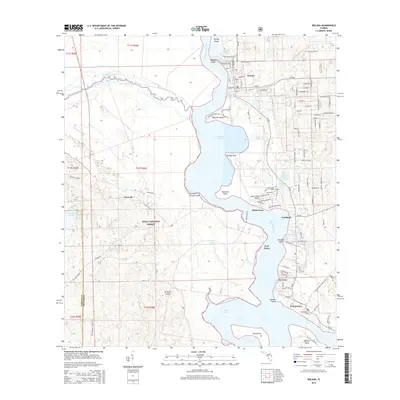
2015 Map of Welaka
USGS Topo · Published 2015About this map
Saint Johns River frontage defines this river-town landscape, where the waterway expands into Little Lake George and winds past numerous islands and named points. The community of Welaka is established at a bend in the river near Welaka Springs, characterized by a grid of street names reflecting a local citrus heritage, such as Lime Ave, Guava Ave, and Strawberry Ln. Further south along the eastern shore, the settlements of Fruitland and Georgetown connect via the river-and-road network, with the latter featuring the Georgetown Cem.
Find a feature on this map
80 named features on this map. Tap any name to fly to it.
Don’t see what you’re looking for? This feature index may not catch every label — zoom into the map to look around manually.
Map Details
Editions of this 2015 Welaka Map
This is the sole edition of this map. No revisions or reprints were ever made.
Other maps of this area

1912 · Palatka
USGS Topo · 1:48,000

1915 · Palatka
USGS Topo · 1:62,500

1915 · Interlachen
USGS Topo · 1:48,000

1916 · Interlachen
USGS Topo · 1:62,500

1944 · Interlachen
USGS Topo · 1:62,500

1949 · Rodman
USGS Topo · 1:24,000

1949 · Interlachen
USGS Topo · 1:62,500

1954 · Daytona Beach
USGS Topo · 1:250,000

1958 · Daytona Beach
USGS Topo · 1:250,000

1964 · Daytona Beach
USGS Topo · 1:250,000