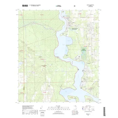
2018 Map of Welaka
USGS Topo · Published 2018About this map
The Saint Johns River corridor defines this part of Putnam County, serving as a primary navigational and ecological artery between Little Lake George and the northern reaches. Along its eastern banks, the settlement of Welaka is established with a grid of street names reflecting a citrus-growing heritage, including Lemon St, Lime Ave, and Orange St. The river's influence is evident in the numerous coves and points like Buzzard Roost Cove and Beecher Point, while the Welaka National Fish Hatchery highlights the importance of the local aquatic environment.
Find a feature on this map
88 named features on this map. Tap any name to fly to it.
Don’t see what you’re looking for? This feature index may not catch every label — zoom into the map to look around manually.
Map Details
Editions of this 2018 Welaka Map
This is the sole edition of this map. No revisions or reprints were ever made.
Other maps of this area

1912 · Palatka
USGS Topo · 1:48,000

1915 · Palatka
USGS Topo · 1:62,500

1915 · Interlachen
USGS Topo · 1:48,000

1916 · Interlachen
USGS Topo · 1:62,500

1944 · Interlachen
USGS Topo · 1:62,500

1949 · Rodman
USGS Topo · 1:24,000

1949 · Interlachen
USGS Topo · 1:62,500

1954 · Daytona Beach
USGS Topo · 1:250,000

1958 · Daytona Beach
USGS Topo · 1:250,000

1964 · Daytona Beach
USGS Topo · 1:250,000