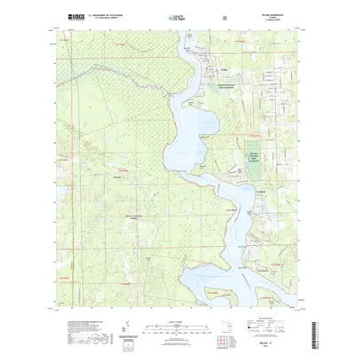
2021 Map of Welaka
USGS Topo · Published 2021About this map
The Saint Johns River defines this riverine landscape, weaving through a complex of lagoons and coves such as Little Lake George and Fruitland Cove. Along the eastern bank, the Welaka National Fish Hatchery occupies a significant tract near the settlement of Welaka, while the western shore is dominated by the dense wetlands of the Ocala National Forest. This map details a specific river-dependent economy where small settlements like Fort Gates and Georgetown are linked by water and historic routes like the Putnam County-Blueways Trl.
Find a feature on this map
89 named features on this map. Tap any name to fly to it.
Don’t see what you’re looking for? This feature index may not catch every label — zoom into the map to look around manually.
Map Details
Editions of this 2021 Welaka Map
This is the sole edition of this map. No revisions or reprints were ever made.
Other maps of this area

1912 · Palatka
USGS Topo · 1:48,000

1915 · Palatka
USGS Topo · 1:62,500

1915 · Interlachen
USGS Topo · 1:48,000

1916 · Interlachen
USGS Topo · 1:62,500

1944 · Interlachen
USGS Topo · 1:62,500

1949 · Rodman
USGS Topo · 1:24,000

1949 · Interlachen
USGS Topo · 1:62,500

1954 · Daytona Beach
USGS Topo · 1:250,000

1958 · Daytona Beach
USGS Topo · 1:250,000

1964 · Daytona Beach
USGS Topo · 1:250,000