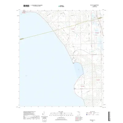
2018 Map of Welaka SE
USGS Topo · Published 2018About this map
Lake George dominates the western half of this 2018 survey, its eastern shoreline defined by notable landforms like Lake George Point, Willow Point, and Ninemile Point. This coastal interface in Volusia County consists of intricate wetlands and secondary water bodies such as Upper Lake Louise and Lower Lake Louise. The map records a landscape where industry-linked roads like Union Bag Trl and Truck Trl No 1 intersect with more established routes such as Lake George Rd. For local historians and genealogists, the inclusion of Braddock Cem near Nelson Ave provides a specific point of interest in an area otherwise characterized by water and timber-related transport networks including Patty Wiggins Br and Price Cr.
Find a feature on this map
50 named features on this map. Tap any name to fly to it.
Don’t see what you’re looking for? This feature index may not catch every label — zoom into the map to look around manually.
Map Details
Editions of this 2018 Welaka SE Map
This is the sole edition of this map. No revisions or reprints were ever made.
Other maps of this area

1954 · Daytona Beach
USGS Topo · 1:250,000

1958 · Daytona Beach
USGS Topo · 1:250,000

1964 · Daytona Beach
USGS Topo · 1:250,000

1970 · Crescent City
USGS Topo · 1:24,000

1970 · Welaka SE
USGS Topo · 1:24,000

1970 · Welaka
USGS Topo · 1:24,000

1970 · Seville
USGS Topo · 1:24,000

1970 · Salt Springs
USGS Topo · 1:24,000

1970 · Pierson
USGS Topo · 1:24,000

1972 · Juniper Springs
USGS Topo · 1:24,000