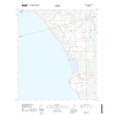
2021 Map of Welaka SE
USGS Topo · Published 2021About this map
The eastern shore of Lake George dominates this central Florida landscape, where the wetland transitions into the residential and agricultural community of Seville. This area is characterized by a high concentration of small lakes and ponds, including Upper Lake Louise, Lower Lake Louise, and Davis Lake, nestled between the riverfront and the inland citrus-growing region. Genealogy researchers will find Braddock Cem located north of Seville, while outdoorsmen can trace the extensive network of the Lake George Conservation Area and its many fire trails like Union Bag Trl. The map details the hydrology of the St. Johns River system, from the marshes of Willow Cove to the southward flow of Price Creek. Prominent landforms along the lake's edge, such as George Point, Willow Point, and Ninemile Point, show the shifting interface between water and the low-lying Florida interior.
Find a feature on this map
60 named features on this map. Tap any name to fly to it.
Don’t see what you’re looking for? This feature index may not catch every label — zoom into the map to look around manually.
Map Details
Editions of this 2021 Welaka SE Map
This is the sole edition of this map. No revisions or reprints were ever made.
Other maps of this area

1954 · Daytona Beach
USGS Topo · 1:250,000

1958 · Daytona Beach
USGS Topo · 1:250,000

1964 · Daytona Beach
USGS Topo · 1:250,000

1970 · Crescent City
USGS Topo · 1:24,000

1970 · Welaka SE
USGS Topo · 1:24,000

1970 · Welaka
USGS Topo · 1:24,000

1970 · Seville
USGS Topo · 1:24,000

1970 · Salt Springs
USGS Topo · 1:24,000

1970 · Pierson
USGS Topo · 1:24,000

1972 · Juniper Springs
USGS Topo · 1:24,000